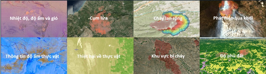
The Forest Fire Warning System is designed to detect and forecast wildfire risks at an early stage to enable timely prevention and emergency response. The system integrates data from forestry meteorological stations and technologies such as thermal sensors, surveillance cameras, satellite imagery, combined with weather indices like high temperatures, low humidity, strong winds, and prolonged lack of rainfall. Based on this data, the system evaluates the fire risk level for each area using a graded warning scale (low, moderate, high, extreme). Early warnings help authorities delineate danger zones, mobilize response forces and equipment, and minimize losses caused by forest fires.
Urgency

Early wildfire warning is crucial for minimizing damage to property, lives, and the environment.
Wildfires can spread rapidly and pose serious threats to humans, wildlife, and vegetation.
A proactive early warning system allows authorities and communities to prepare, prevent fire spread, and protect critical forest zones.
Model for Fire Warning and Prediction
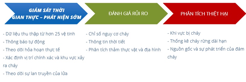
Fire detection and forecasting models are used to predict fire probability and simulate fire spread dynamics.
Enables forest management units to monitor and control wildfires, ensuring human safety and sustainable forest management.
Supports resource planning and fire prevention strategies to avoid large-scale fire outbreaks.
Meteorological stations: Measure rainfall, wind, temperature & humidity, air pressure, smoke, soil moisture, etc.
Real-time image surveillance: Includes PTZ cameras, dome cameras, and geostationary satellite feeds.
Data transmission: Uses radio, satellite, or Internet (3G/4G/5G) to send data to central systems.
Data acquisition system: Includes servers and workstations.
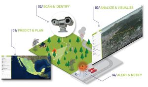
Satellite-Based Early Warning Model
 This solution is designed to provide the earliest possible detection of hotspots and enables users to track high-risk wildfire areas.
The all-in-one solution is powered by reliable, consolidated data from over 25 geostationary satellites, combined with leading fire detection algorithms to protect people, ecosystems, and assets.
Thermal and AI-Powered Camera Warning Model
Real-time monitoring: Images are continuously updated across systems and accessible on computers or smartphones.
Smart camera technology: Combines image data with geospatial intelligence to pinpoint high-risk fire zones.
Multi-dimensional information: AI detects smoke patterns through light data, satellite inputs, and more-leading to more accurate decision-making.
AI algorithms trained on millions of images can identify smoke and determine locations with up to 99% accuracy in under one minute.
Contact us for more information!
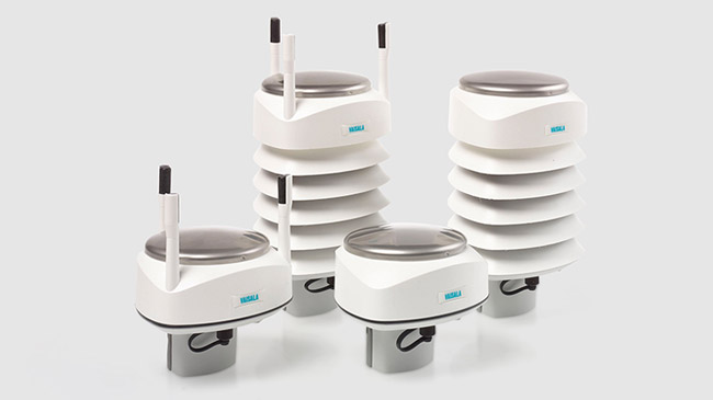
Manufacturer: Vaisala Model: PWD22
Manufacturer: Vaisala Model: PWD20
Manufacturer: Vaisala Model: PWD12
Manufacturer: Vaisala Model: PWD10
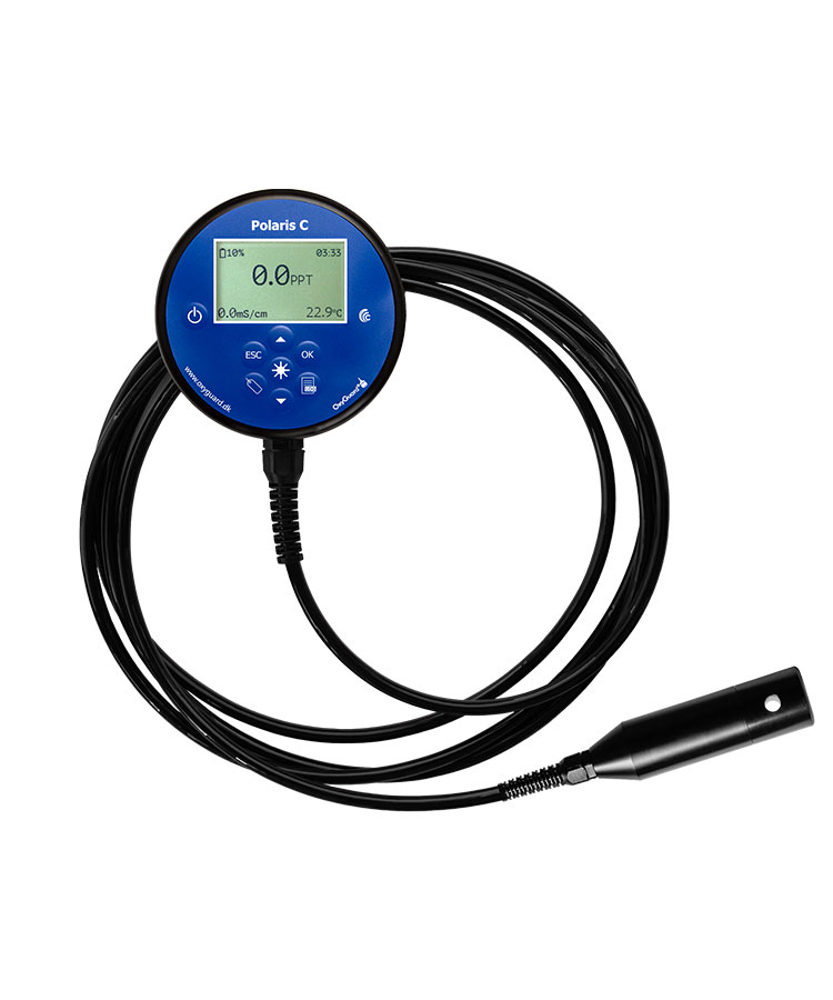
Manufacturer: Oxyguard Model: H09-25
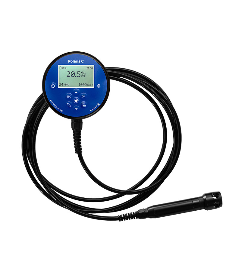
Manufacturer: Oxyguard Model: H02A-25
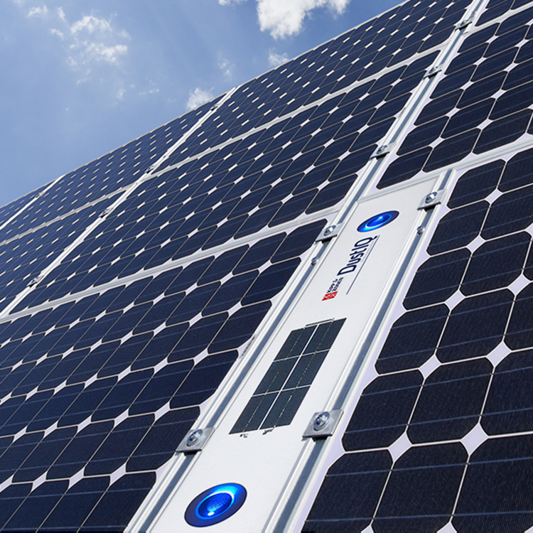
Manufacturer: Kipp & Zonen Model: DustIQ
1. General Introduction An FLS is a system for measuring wind and metocean conditions, installed on an offshore floating platform, and uses LiDAR (Light Detection and Ranging) technology to remotely measure wind without the need for a fixed meteorological mast. BA-FLS-NX5 is the commercial model of FLS which is designed based on proven technologies and […]
Manufacturer: Vaisala Model: WindCube® Scan
Manufacturer: Vaisala Model: WindCube® 2.1 XP
Manufacturer: Kipp & Zonen Model: SMP10x
Manufacturer: Kipp & Zonen Model: SMP22X
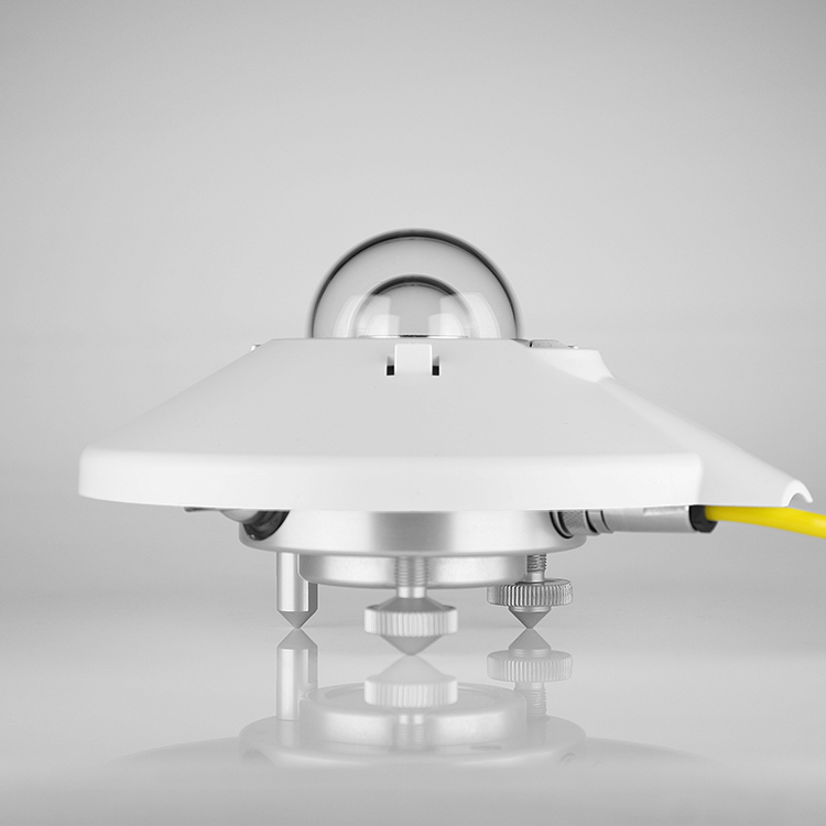
Manufacturer: Kipp & Zonen Model: CMP22
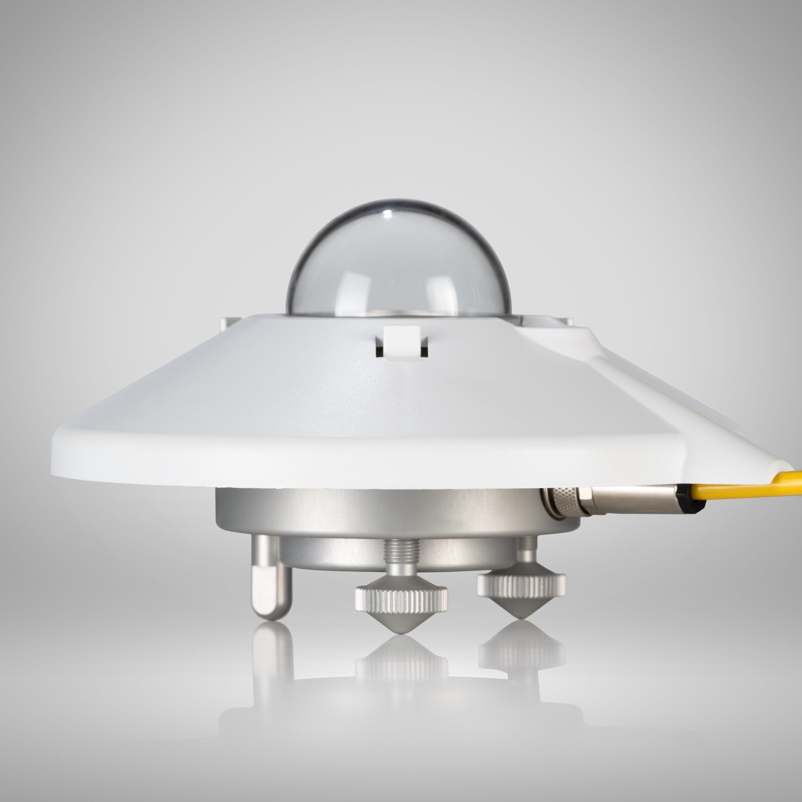
Manufacturer: Kipp & Zonen Model: SMP12
Manufacturer: Vaisala Model: WXT530
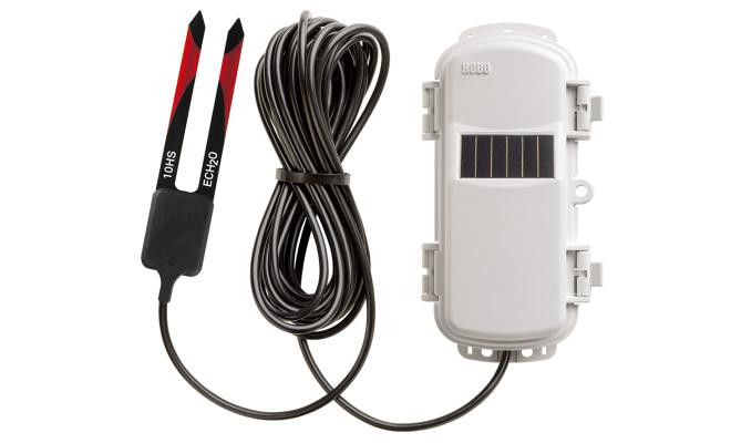
– Manufacturer: HOBO – Model: ECH2O™ 10HS
– Manufacturer: HOBO – Model: MicroRX
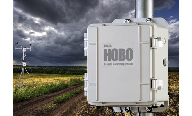
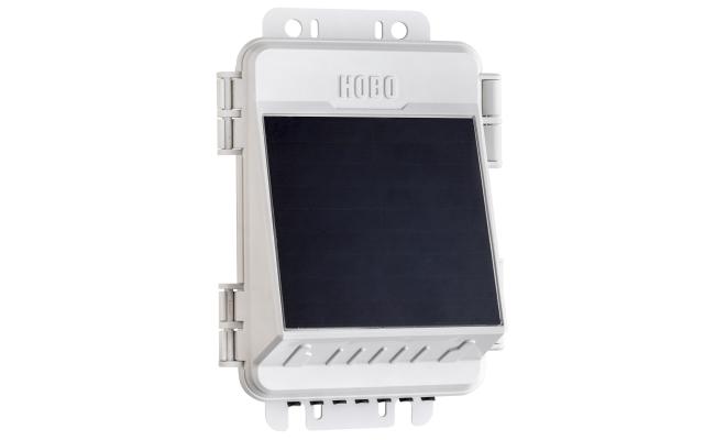
– Manufacturer: HOBO – Model: RX3000
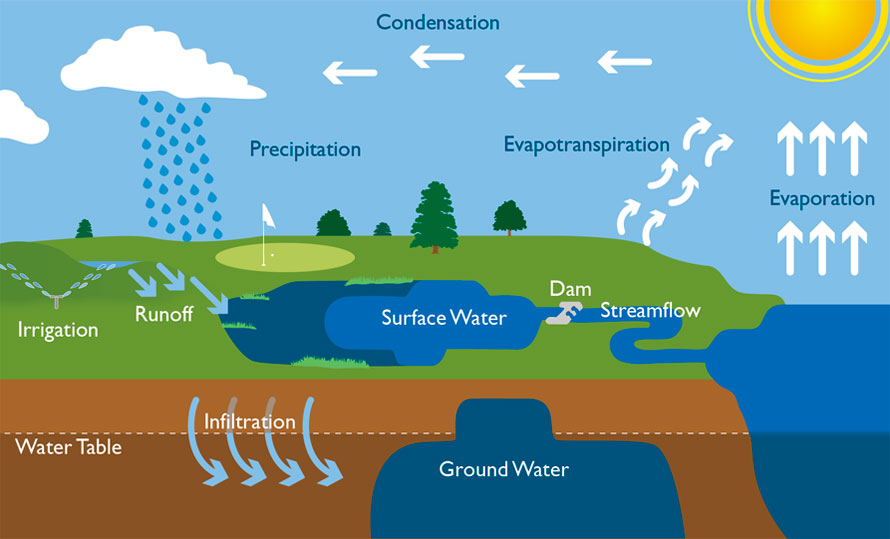
Groundwater is water located beneath the earth’s surface, accumulated in soil layers, rocks, or in fractures and pores of rock and soil formations. Groundwater can exist at various depths, ranging from a few meters to hundreds of meters below the surface. It is a vital resource used for domestic, agricultural, and industrial purposes, […]
Contact us for more information!
Contact us for more details !
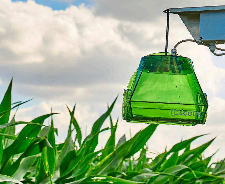
In-Field Meteorological Monitoring is a solution designed to observe and record weather conditions directly at agricultural cultivation sites, including air temperature, humidity, rainfall, wind speed and direction, solar radiation, soil temperature and moisture, among others. The system utilizes automated sensors with real-time data transmission, enabling farmers to promptly access microclimatic conditions in their fields. This […]
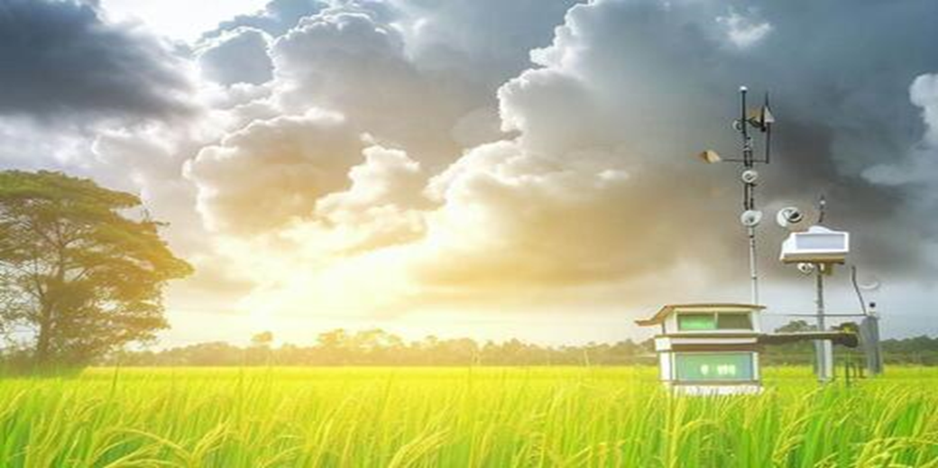
An agricultural weather station is a system of devices installed in farming areas to collect environmental data such as temperature, air humidity, rainfall, solar radiation, wind speed and direction, soil moisture, and more. This data is transmitted to a centralized management platform, allowing farmers and agribusinesses to monitor real-time weather conditions and make informed decisions […]
Benefits of Hydrological Monitoring for Agriculture • Accurate weather forecasting • Efficient water resource management • Disaster prevention and damage mitigation • Optimization of fertilizer and pesticide usage • Increased […]

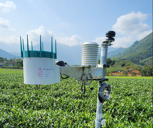
Forest Meteorology is the application of meteorological data and information in the management, protection, and sustainable development of forests. Through dedicated monitoring stations, forest meteorology systems track environmental parameters such as: air temperature, humidity, precipitation, wind, solar radiation, and soil moisture within forested areas. The collected data supports wildfire risk forecasting, climate change impact assessment […]
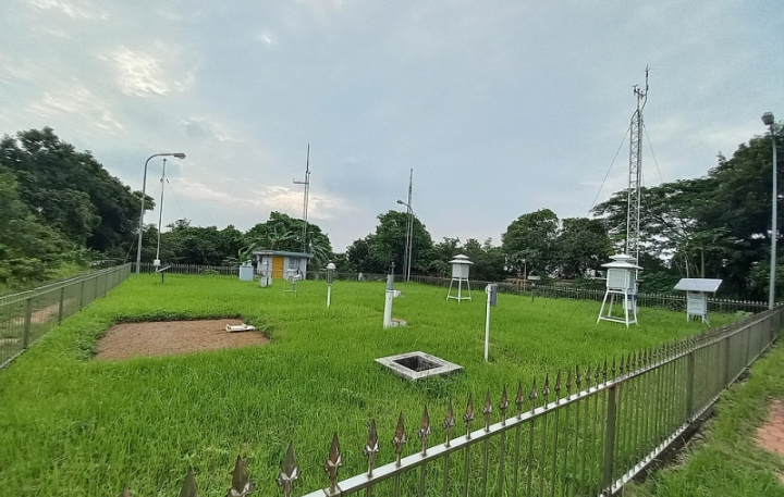
A conventional meteorological station provides real-time data on temperature, humidity, wind, and atmospheric pressure to support accurate weather forecasting. It enables the monitoring of extreme weather events such as storms, floods, and droughts, assisting in rapid disaster response. Data collected from the station supports long-term climate trend analysis, contributing to climate change assessment. In agriculture, […]

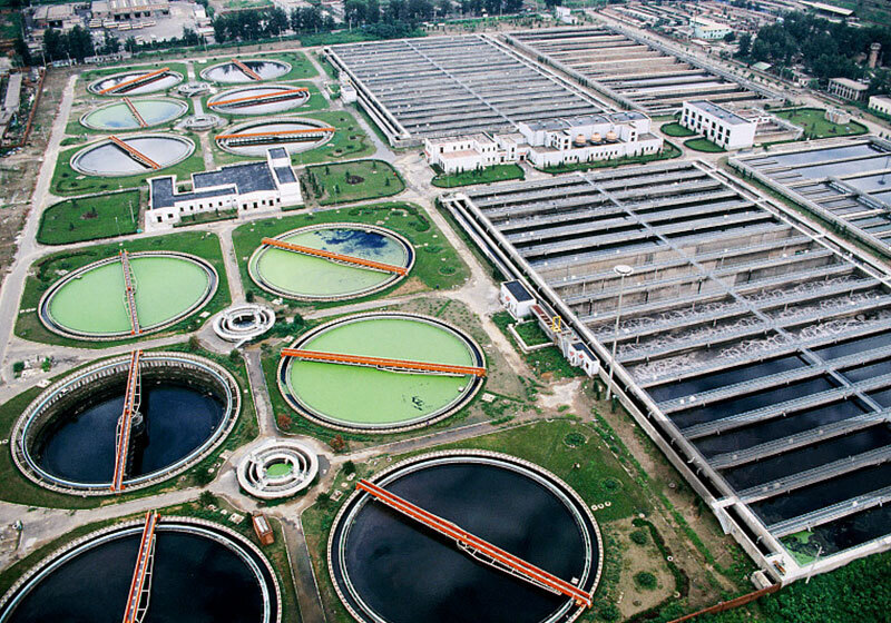
Overview Monitoring wastewater sources from industrial zones is essential to protect the environment and public health. Protect public health Manage water resources effectively Detect and prevent pollution Forecast natural disasters and climate change Preserve and sustain aquatic ecosystems Support scientific research and development planning Ensure sustainability of development projects Strengthen international cooperation and fulfill environmental […]
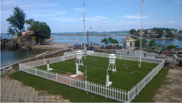
Objectives and Responsibilities Meteorological and oceanographic (hydro-meteorological) observations at seaports in Vietnam play a vital role in ensuring safety and efficiency for maritime operations and related sectors. Specifically, these include: Maritime safety management Marine environmental protection Sustainable development Transportation and commercial activities Disaster prevention and climate change adaptation Legal Framework Decree No. […]

The Forest Fire Warning System is designed to detect and forecast wildfire risks at an early stage to enable timely prevention and emergency response. The system integrates data from forestry meteorological stations and technologies such as thermal sensors, surveillance cameras, satellite imagery, combined with weather indices like high temperatures, low humidity, strong winds, and prolonged […]
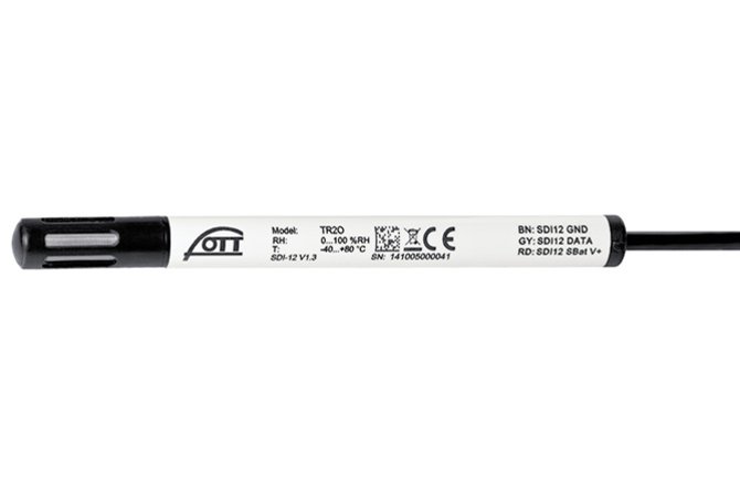
The OTT TRH is a compact sensor designed to measure relative humidity and air temperature. In addition, it is capable of calculating parameters such as absolute humidity and dew point, and transmits data via the SDI-12 interface. The sensor includes a protective cap that prevents dust and debris from entering the sensing elements. The optional […]

Contact us for more information!
Contact us for more information!
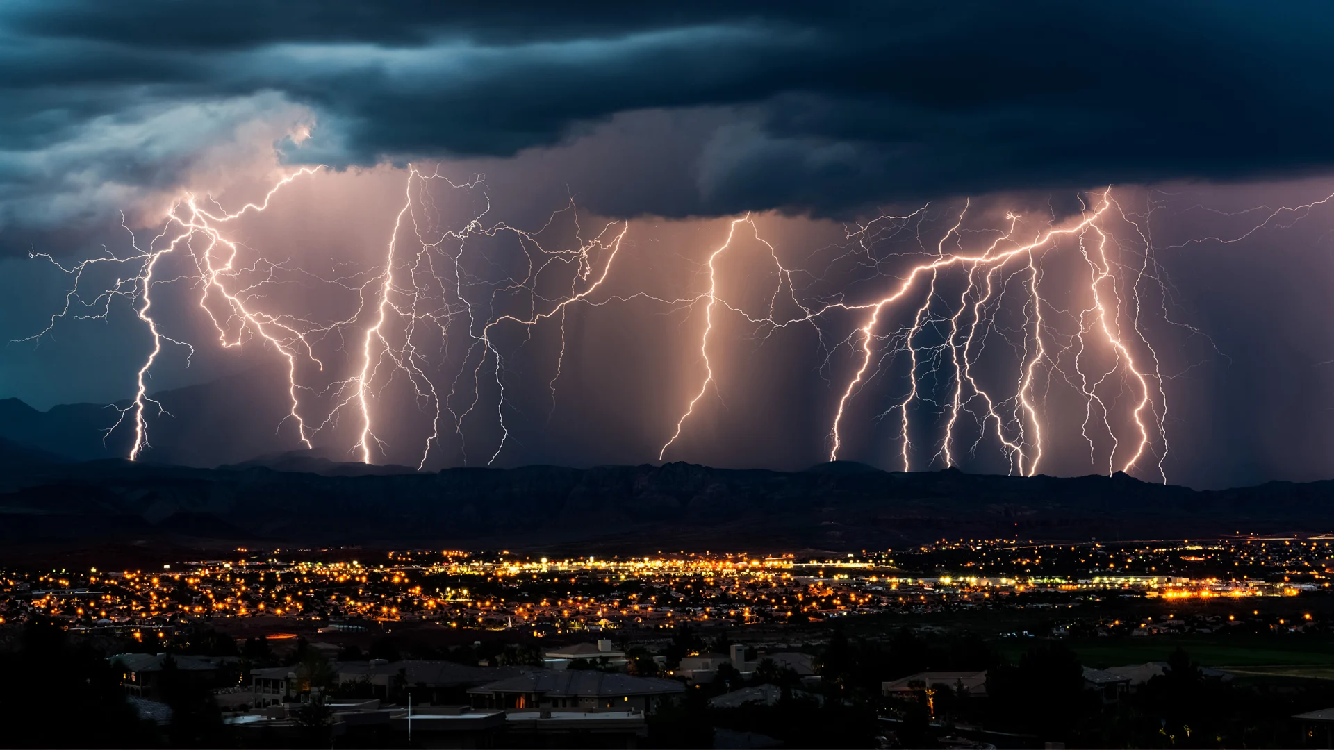
The lightning detection system utilizes a network of electromagnetic, radio wave, or very high frequency (VHF/UHF) sensors to detect electrical impulses generated by lightning strikes. By measuring the time of arrival of signals at multiple widely distributed sensors, the system can accurately calculate the location, movement direction, and intensity of the lightning. This is an […]
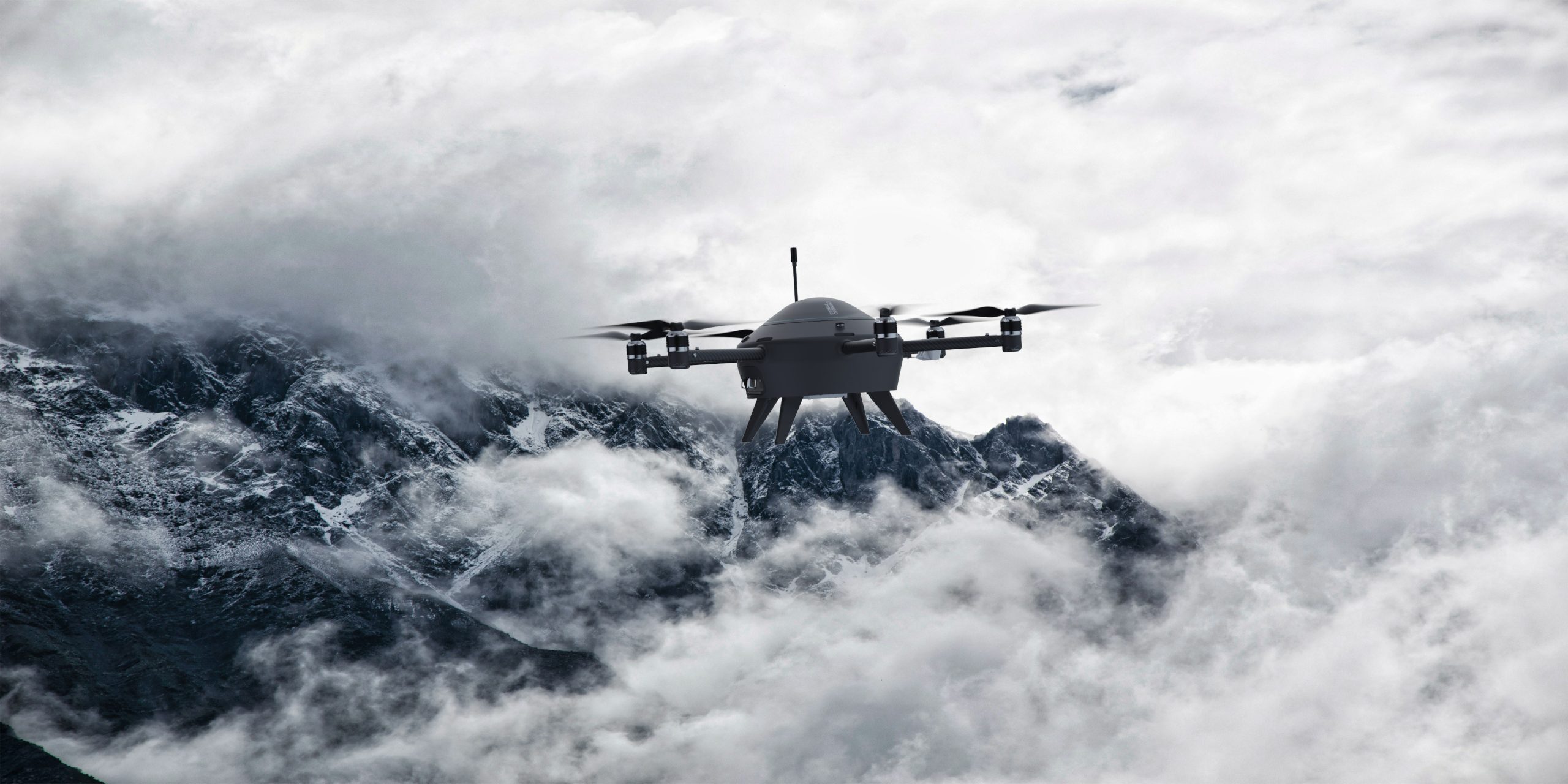
Vertical Wind Profiling Using Drones – A Breakthrough in Modern Meteorological Observation In the context of increasing climate change and extreme weather events, improving the quality of meteorological data has become essential. One of the most critical parameters in weather forecasting is vertical wind data, which directly influences phenomena such as fog, thunderstorms, convection, and […]
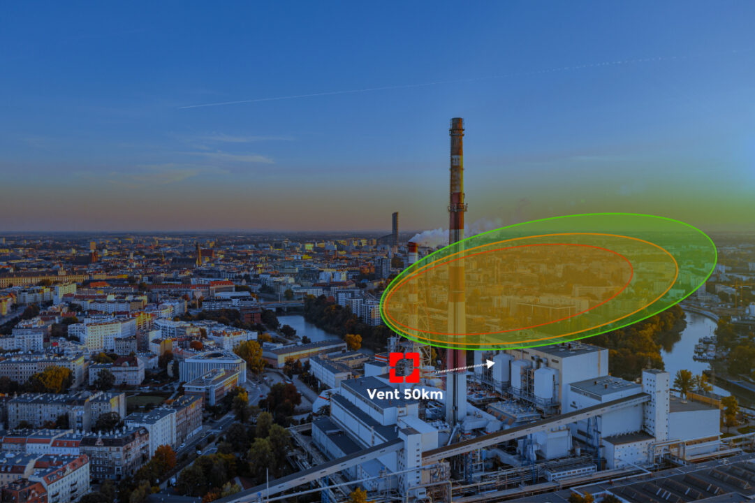
Introduction The air quality monitoring solution is an integrated ecosystem combining intelligent sensor devices, real-time data analytics platforms, and artificial intelligence (AI) technologies to monitor, detect, and analyze air pollution factors. Our solutions go beyond basic measurement—providing modeling capabilities, early warning systems, and decision-support tools for effective environmental management. LASI provides compact, high-precision environmental monitoring […]
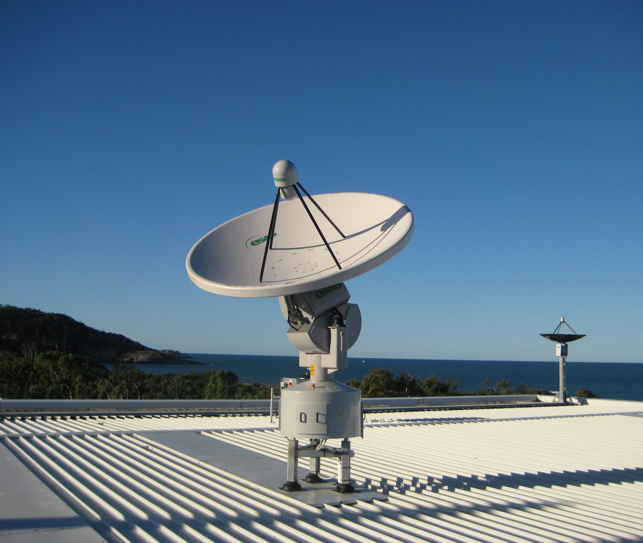
Introduction to HimawariCast Groundstation System The HimawariCast System is a high-performance automatic satellite ground receiving station designed to receive meteorological cloud imagery from Japan Meteorological Agency’s Himawari-8 satellite via the HimawariCast Service. Operating in the C-band, the system collects, decodes, and visualizes satellite data to support meteorological monitoring and forecasting. Main System Components 1. Receiving […]
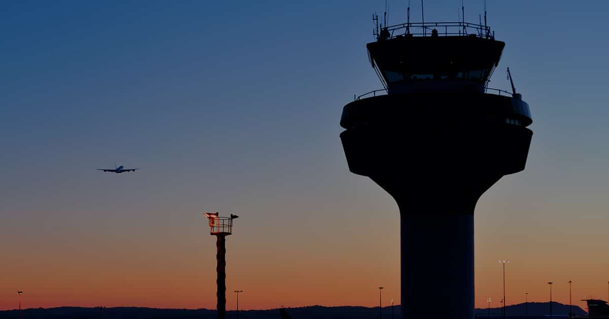
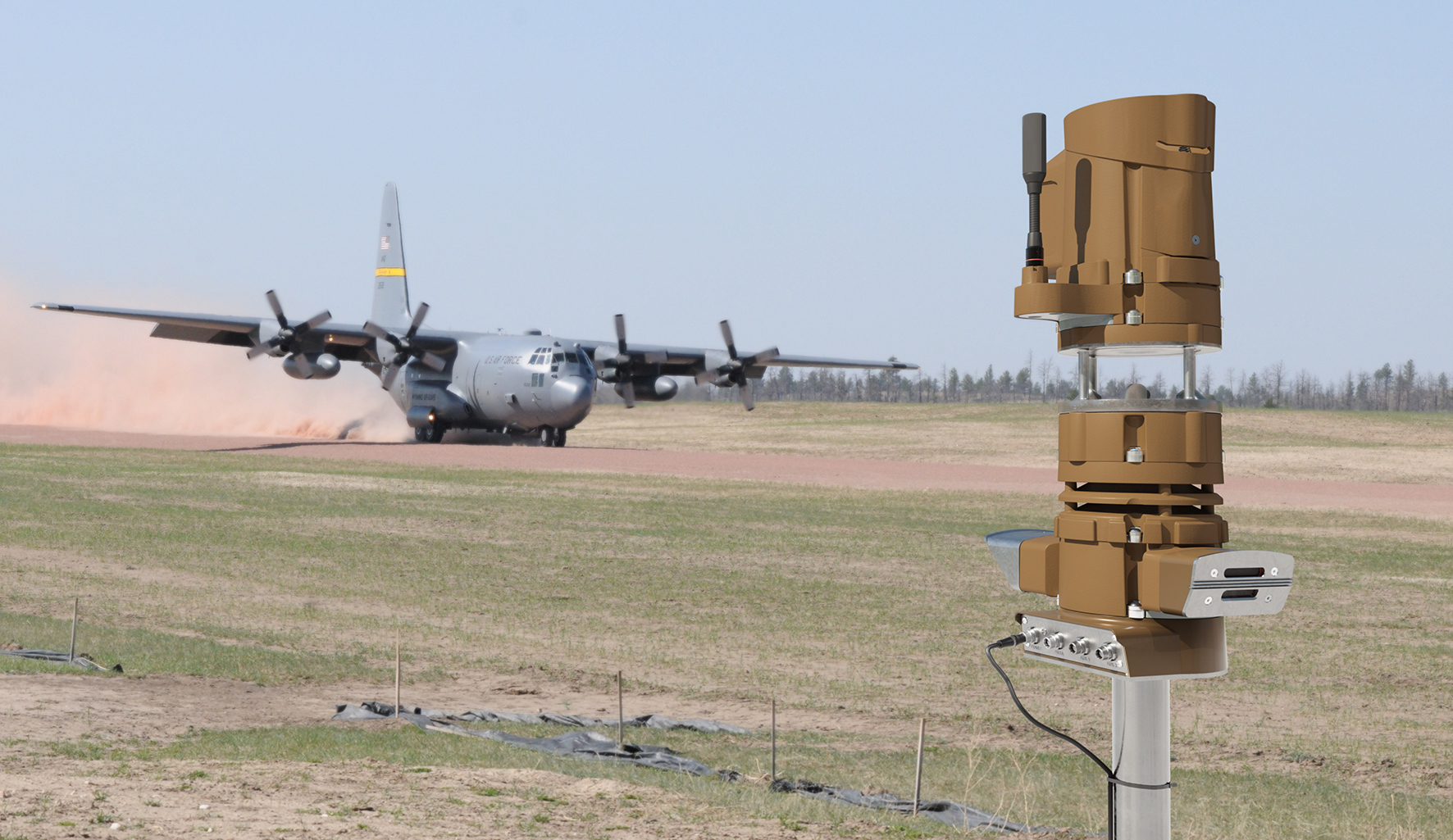
1. Overview of the Aviation Meteorological Monitoring System The Aviation Meteorological Monitoring System is an integrated set of advanced equipment and technologies installed at airports to collect, process, and deliver real-time, continuous, and accurate weather information in support of aviation safety operations such as takeoff, landing, and air traffic control. The system consists of multiple […]
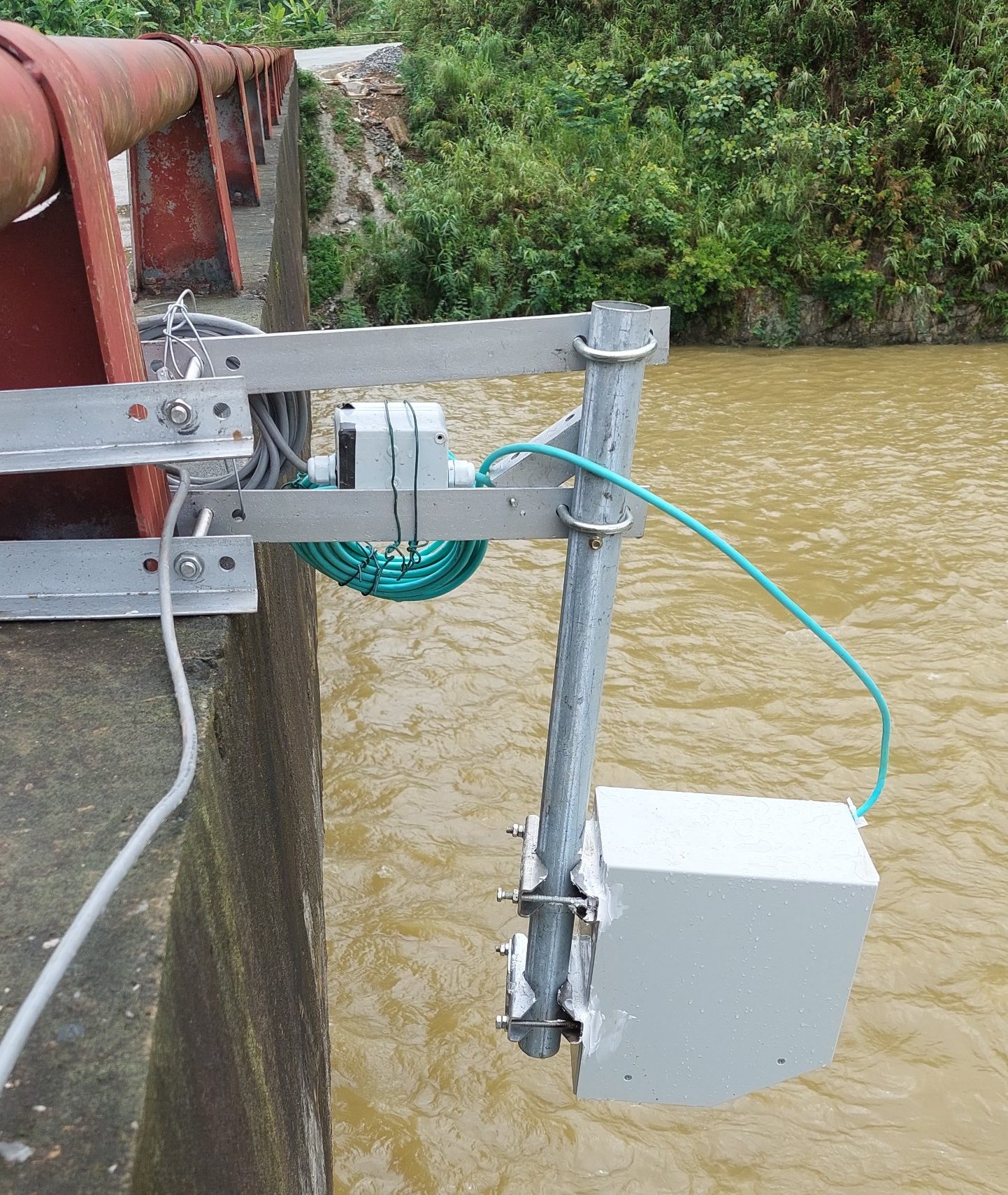
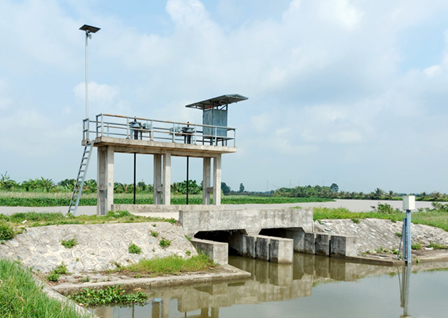
1. System Overview of Water Flow Monitoring Station The Water Flow Monitoring Station is a specialized system designed for deployment at rivers, streams, irrigation channels, or stormwater drainage systems. It continuously and accurately monitors water flow rates in real-time. This system provides essential data to support water resource management, disaster prevention, and hydraulic structure operation. […]
Overview Our solution provides a comprehensive end-to-end system, from hardware to software, fully compliant with current environmental monitoring regulations, including: Decree No. 05/2025/NĐ-CP Decree No. 08/2022/NĐ-CP Circular No. 10/2021/TT-BTNMT Circular No. 47/2011/TT-BTNMT (QCVN 40:2011/BTNMT) The system is fully integrated and compact, helping reduce costs and save time, with continuous measurement results transmitted in real […]
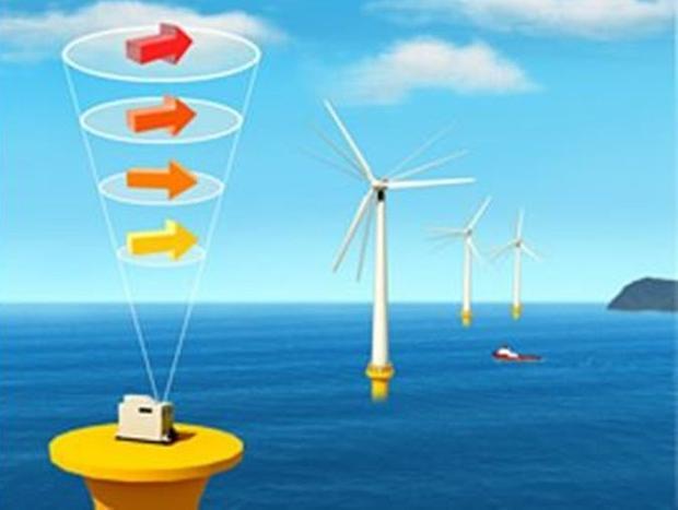
1. System Overview The Wind LiDAR solution is deployed to measure wind speed, direction, and structure in both vertical and horizontal profiles at various heights in the atmosphere—without the need for traditional meteorological towers. Its main objective is to improve the accuracy and efficiency of wind resource assessment, supporting the planning and development of wind […]
Introduction to the Mobile Automatic Weather Monitoring System The Mobile Automatic Weather Monitoring System is a compact, wireless, and customizable weather station designed to replace traditional AWS systems, which often require fixed power sources and complex installation infrastructure. With its modular architecture, the system supports integration of up to eight meteorological sensors and offers satellite […]
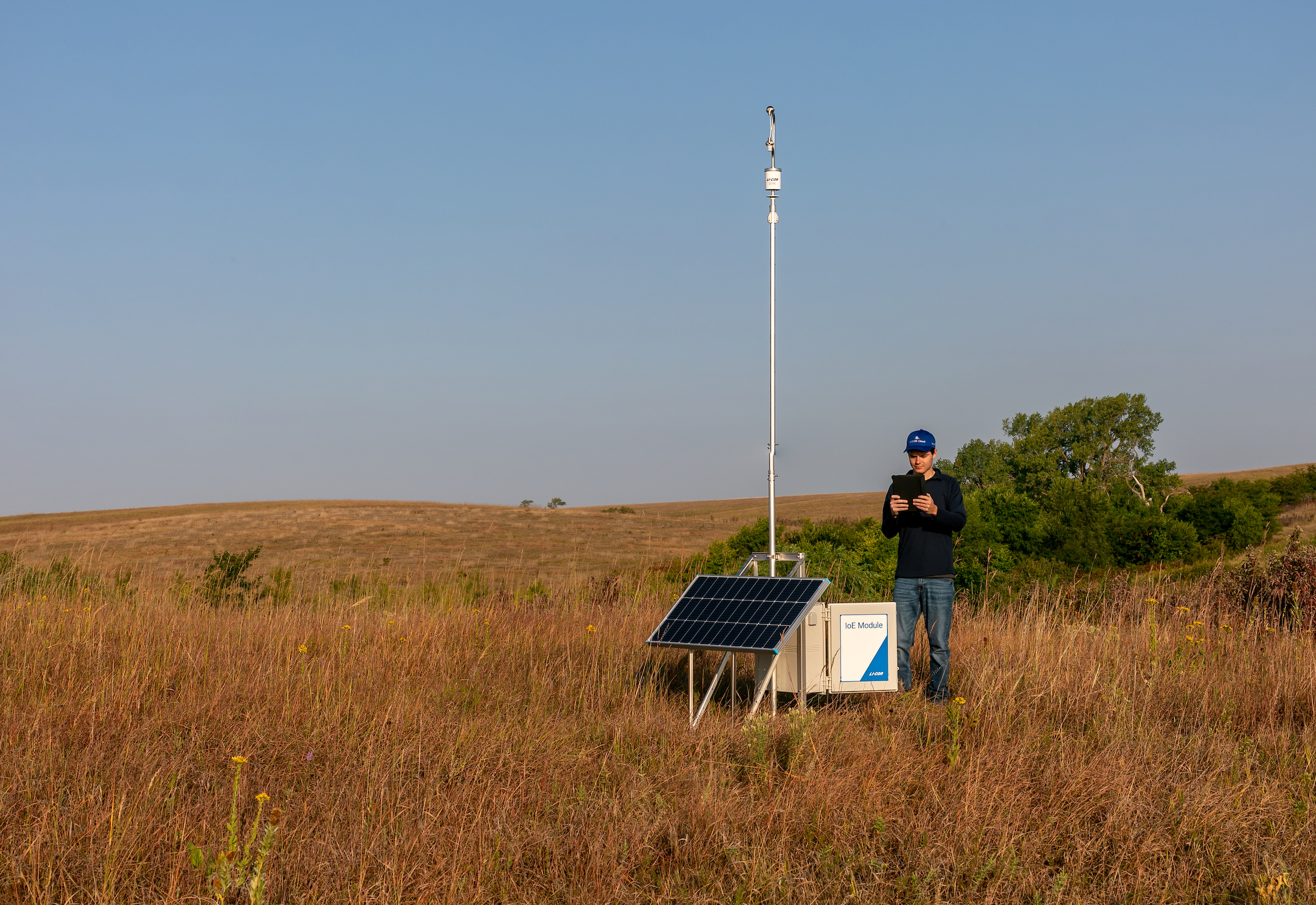
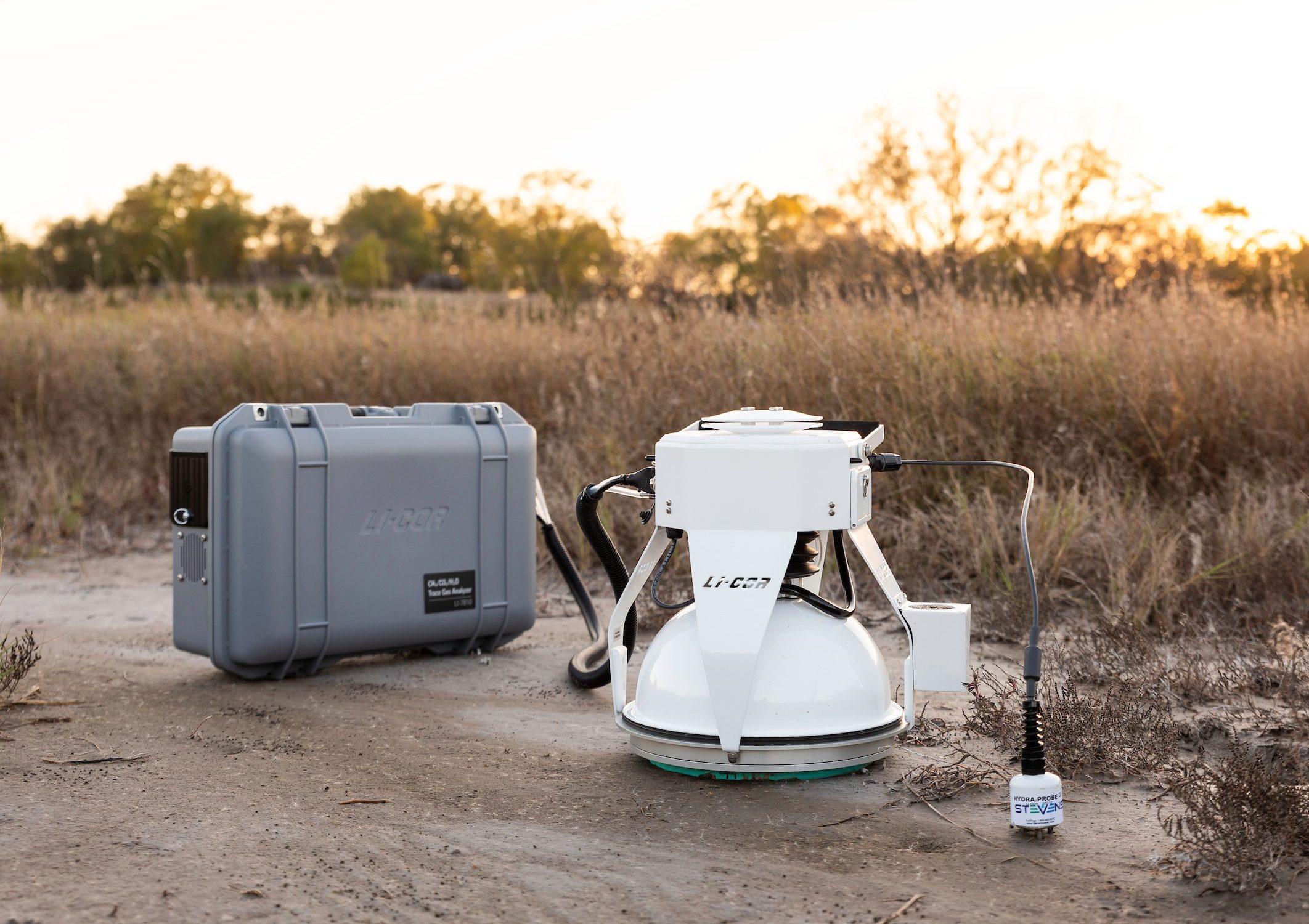
Introduction to the CO₂ Flux Monitoring System – Carbon Node The Carbon Node is an advanced solution for carbon monitoring, providing direct and accurate measurements of carbon dioxide (CO₂) fluxes in ecosystems. The system is designed to simplify data collection, enabling researchers to deploy easily, access data quickly, and scale up monitoring networks with ease. […]
Gill WindObserver 65 is a high-precision ultrasonic wind sensor with a rugged construction, providing accurate wind speed and direction data via digital output. The sensor features a stainless steel housing rated to IP66, making it especially suitable for saline environments such as coastal and offshore areas. This wind sensor includes an optional de-icing system, enabling […]
Introduction to the Automated Greenhouse Gas Monitoring System Using Chamber Method The chamber method is one of the most widely used techniques to measure the concentration and fluxes of greenhouse gases such as CO₂, CH₄, and N₂O between the soil or water surface and the atmosphere. This method is especially useful in ecological, agricultural, and […]

Introduction to the Evaporation and Evapotranspiration Monitoring System The Evaporation and Evapotranspiration Monitoring System is a comprehensive and advanced solution for measuring actual evapotranspiration (ET). Unlike indirect methods that estimate ET based on vegetation indices, canopy coverage, or meteorological models, this system delivers real-time, direct, and accurate measurements of evaporation and transpiration, supporting efficient water […]
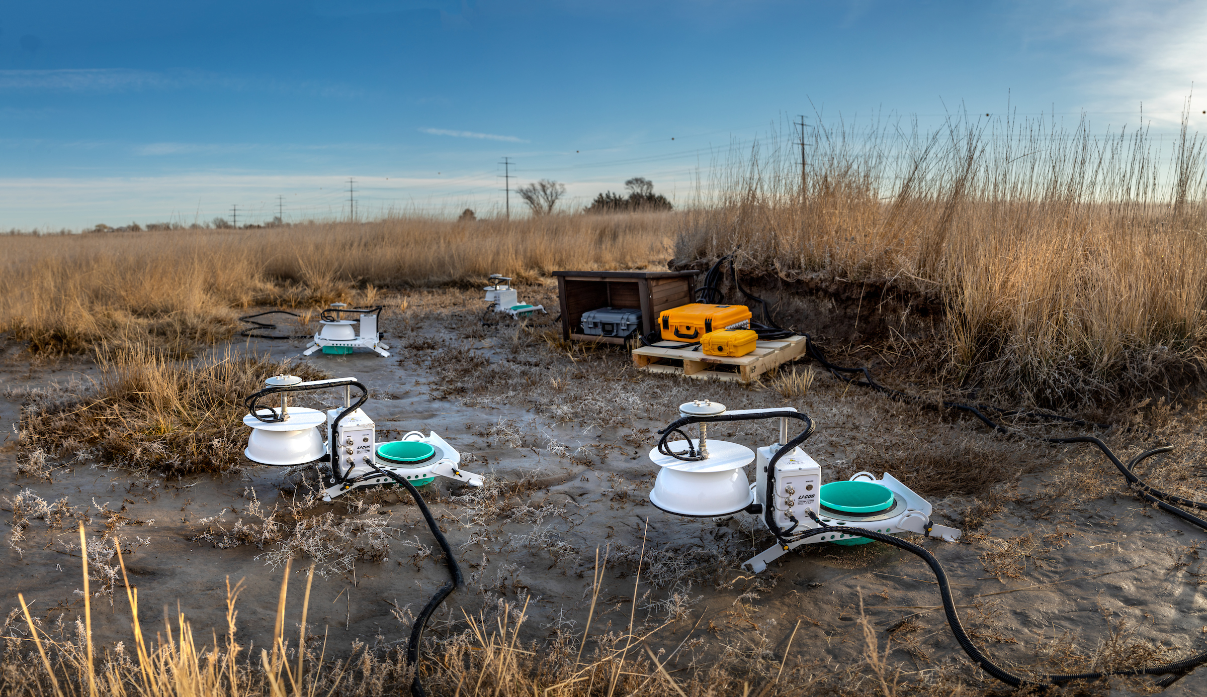
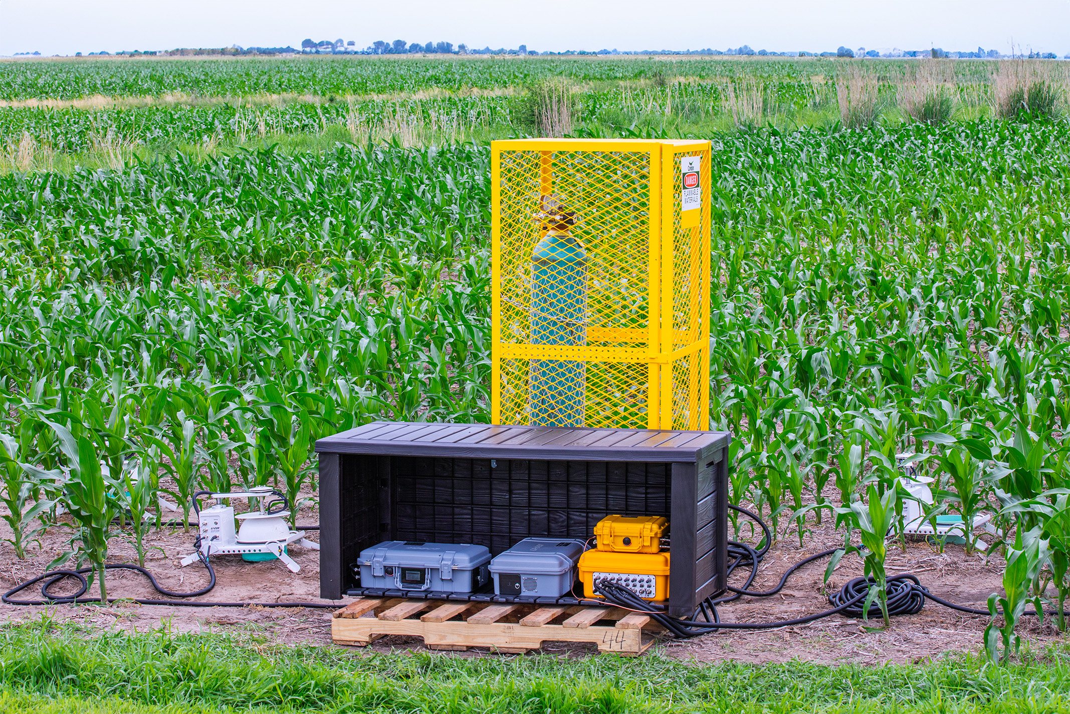
Introduction to the Soil Greenhouse Gas Emissions Monitoring System The Soil Greenhouse Gas Emissions Monitoring System is an automated solution for continuous measurement of key greenhouse gases including CO₂, CH₄, and N₂O. With support for up to 36 sampling chambers, the system enables data collection from multiple locations over extended periods, covering areas up to […]
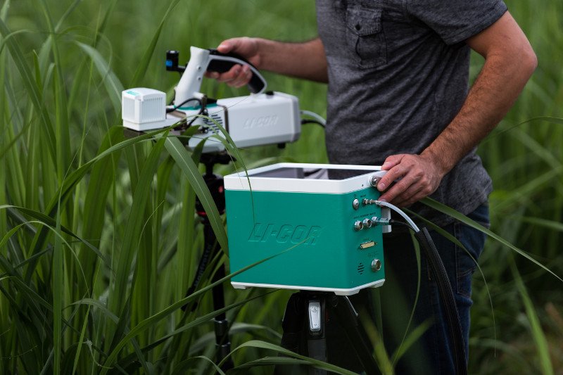
LI-6800 Portable Photosynthesis System The LI-6800 is the most advanced photosynthesis measurement system available today, offering high precision, rapid response, and optimized environmental control. It is the leading tool for research in photosynthesis, plant physiology, and ecological studies. Key Features High Precision: Advanced sensors provide accurate measurements of photosynthetic and transpiration parameters. Environmental Control: Allows […]

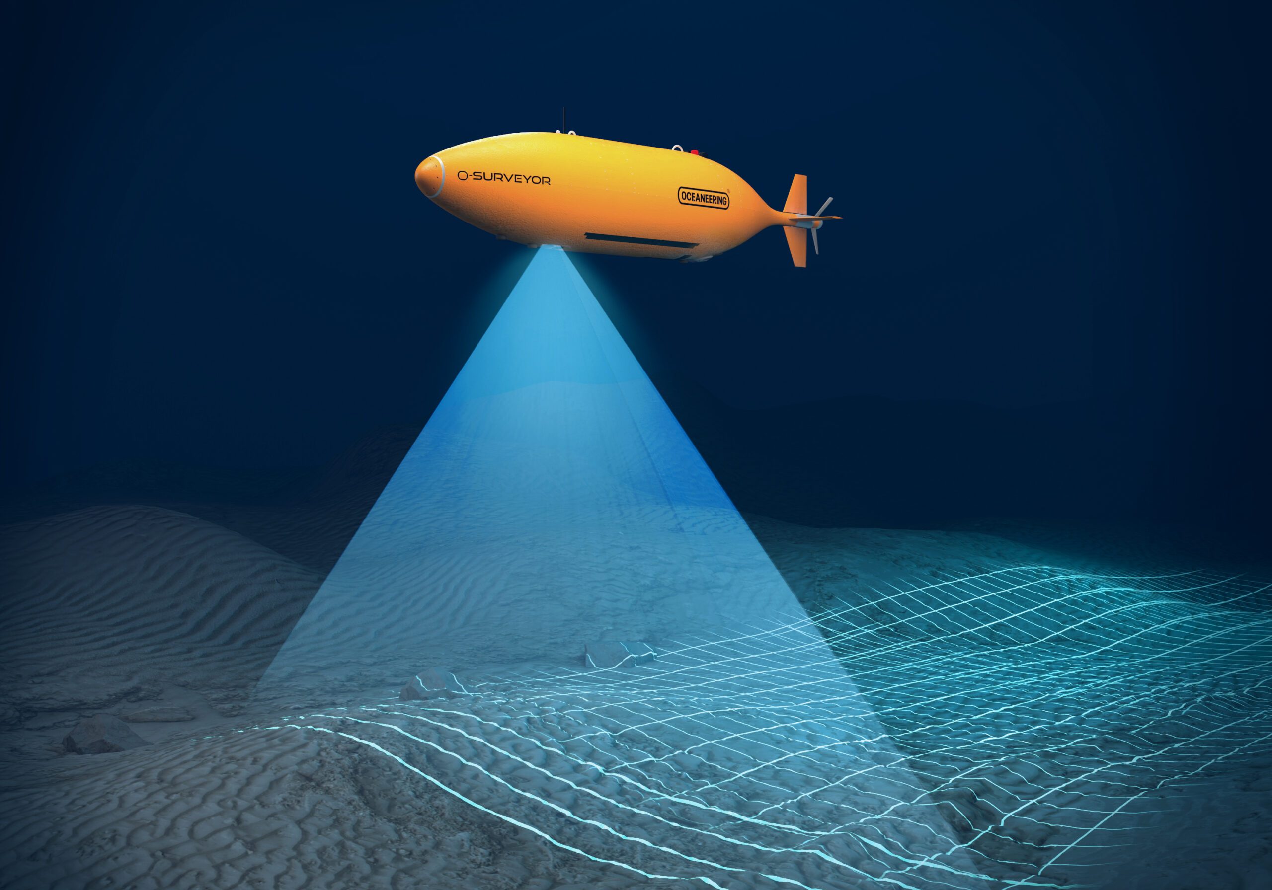
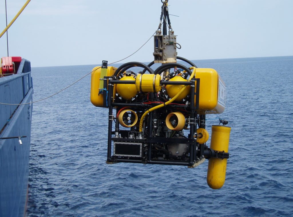
APPLICATIONS Aquaculture Aquaculture is a vital source of food, nutrition, income, and livelihood for millions of people worldwide. The use of ROVs (Remotely Operated Vehicles) allows operators to manage aquaculture farms more effectively. ROVs are deployed in fish farming to perform tasks such as net inspection, lighting, feeding, troubleshooting, and fish stock monitoring. […]
The Flood Warning Tower is an on-site disaster alert infrastructure designed to provide early warnings of rising water levels and potential flood risks to communities living near rivers, streams, reservoirs, or low-lying areas. This is a visual and cost-effective warning solution, particularly suitable for rural and mountainous regions where access to advanced technology and communication […]
Introduction to the Soil Greenhouse Gas Emissions Measurement System The Soil Greenhouse Gas Emissions Measurement System is a flexible monitoring solution designed to measure emissions of CO₂, CH₄, and N₂O from soil. This system is engineered to collect real-time, high-precision data, supporting research in climate change, carbon cycling, and the environmental impacts of agricultural and […]