In the context of increasing climate change and extreme weather events, improving the quality of meteorological data has become essential. One of the most critical parameters in weather forecasting is vertical wind data, which directly influences phenomena such as fog, thunderstorms, convection, and aviation conditions.
Meteodrone is a specialized drone capable of performing high-resolution vertical wind profiling with speed, accuracy, and efficiency. This technology is gradually replacing traditional methods thanks to its flexibility and ability to operate under harsh weather conditions.
Vertical flights up to 6,000 meters: Enables wind measurements from ground level to the lower troposphere.
Equipped with multi-meteorological sensors: Measures temperature, humidity, pressure, dew point, and computes wind speed at various altitudes.
All-weather operation: Heated rotor system allows reliable performance in rain, fog, and snow.
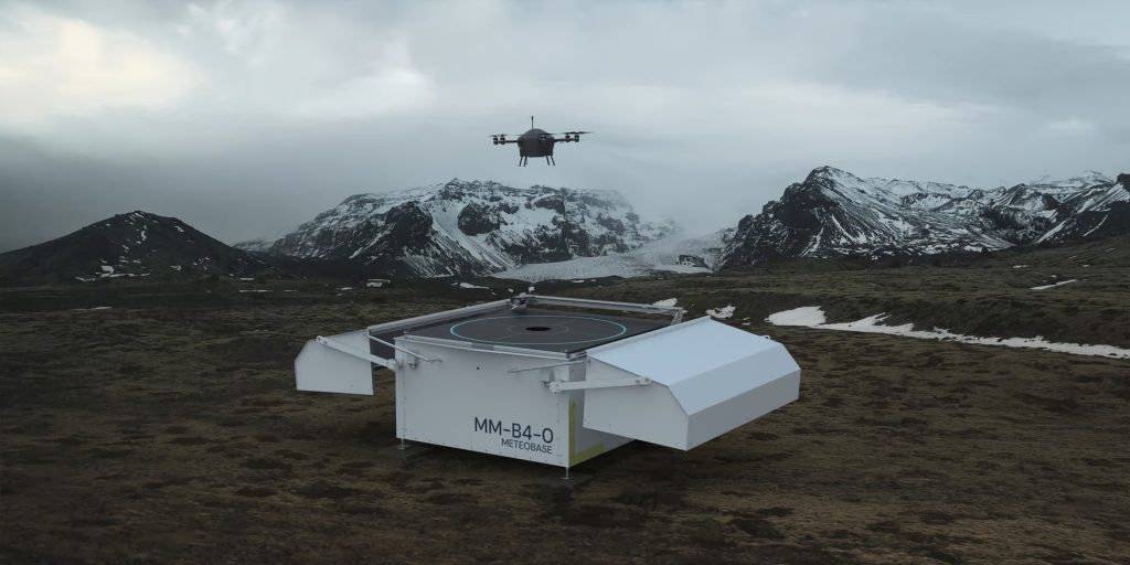
Integrated with Meteobase ground station: Supports remote autonomous operation, smart flight planning, and real-time data transmission.
Extreme weather forecasting: Enhances accuracy in forecasting thunderstorms, lightning, hail, and fog.
Climate research: Supports analysis of tropospheric structure and atmospheric layer interactions.
Monitoring in complex terrain: Enables wind profiling in mountainous or valley regions where traditional radar is ineffective.
Aviation & airport safety: Provides low-altitude wind data for early windshear warnings, ensuring safer takeoffs and landings.
Contact us for more information!


