1. System Overview
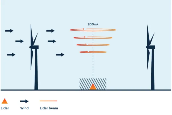
The Wind LiDAR solution is deployed to measure wind speed, direction, and structure in both vertical and horizontal profiles at various heights in the atmosphere—without the need for traditional meteorological towers.
Its main objective is to improve the accuracy and efficiency of wind resource assessment, supporting the planning and development of wind power projects, as well as monitoring weather conditions and atmospheric phenomena from local to regional scales.
2. Applications
Measure and analyze wind data by height (from 10 to 300+ meters)
Determine optimal siting and configuration for wind turbines
Support energy yield modeling and project feasibility assessment
Provide input data for CFD modeling of wind flow fields
Reduce wake effects between turbines
Assist in turbine layout for maximum efficiency
Forecast incoming wind flows
Adjust turbine yaw (yaw control)
Adjust blade pitch (pitch control)
Optimize power generation in real time
Detect wind anomalies (e.g., shear, turbulence) affecting turbine operation
Reduce wear and extend equipment lifespan
Support condition-based maintenance planning based on real-time data


